Adventures on Yarramundi
27 October 2012
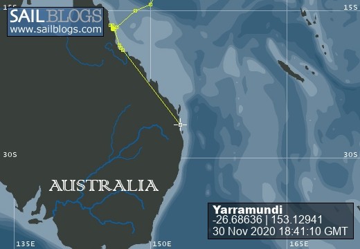
22 August 2012 | Trinity Inlet, Cairns
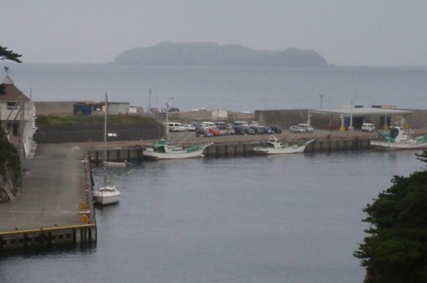
17 August 2012 | Cairns Harbour
16 August 2012 | 14 56.8653'S:148 11.3993'E, The Coral Sea
15 August 2012 | 14 14.19156'S:149 5465'E, The Coral Sea
14 August 2012 | 13 12.0330'S:150 26.6810'E, Still in PNG Waters, Coral Sea
14 August 2012 | 70 miles north east of Australian Waters, Coral Sea
13 August 2012 | N N'N:E E'E, The Coral Sea
13 August 2012 | N N'N:E E'E, Solomon Sea
12 August 2012 | N 'N:E 'E, Solomon Sea
11 August 2012 | 'N: 'E, Solomon Sea
10 August 2012 | N N'N:E E'E, Solomon Sea - South of Deep Planet
09 August 2012 | N 'N:E 'E, Solomon Sea
09 August 2012 | 'N: 'E, Solomon Sea
09 August 2012 | Blanche Bay 4 miles from Rabaul
08 August 2012 | Rabaul Yacht Club
07 August 2012 | Rabaul Yacht Club
06 August 2012
06 August 2012 | Rabaul Yacht Club
05 August 2012 | Rabaul Yacht Club
A rough night as we crossed the 8th parallel
30 June 2012 | 140 miles from Woleai, Federated States of Micronesia. The Caroline Islands.
David
As we came close to Sorol Atoll in the evening I decided to go off our course and give it a wide 6 mile berth on the lee side. Faraulep where we hit the reef was 1.6 miles from where it was on the charts so wanted to be sure there was enough space from this one. By the time I got there the wind had shifted and instead of being in the lee we were on the windward side. Still 6 miles is a safe distance so no problem. However the wind was around 20 knots gusting to 26 with simply torrential rain. The stuff you only get in the tropics that reduces visibility to nothing. It made the radar useless as all it could see was rain too. I need radar to see other ships at night so we donft run into each other. Ifd pop up out of the cabin to check every so often but there was no point. There was so much rain I could not see more than a few metres and so much water over the plotter I could not read it either. I kept telling myself I am being paranoid. No boats out here. But the other voic e was saying donft assume so, you need to know if anybody is out there.
As I dried off I then noticed the VHF radio tuned to channel 16 using up power and thought hmm, why donft I just call out and see if there are any boats around. Like that Pink Floyd line (which will make David and Darshaun laugh) I got on the radio and simply asked if there was anybody out there. No response. Well I guess I can relax in this dry cabin for now. Boat on autopilot, sails set and reefed conservatively. An hour later I upgraded my VHF call out request, got on the radio and said ethis is sailboat Yarramundi doing a radio checkf. To my surprise a voice with an Indian accent came out perfectly clearly saying got your radio check Yarramundi. He even got the pronunciation of Yarramundi correct. Where are you...err what are your coordinates and course. He responded and I wrote them down and plotted his course. Shit ? he is only 4.5miles away. Worse, he passed me by a mile. A leapt up into the cockpit with a towel and dried off the plotter (boat navigation screen). S till all that rain about messing up the radar but sure enough on AIS* a little triangle signifying a ship. Clicked on it to find that its name was Colorado. I confirmed his course and where we passed and got back on the radio. eDid you see mef. eNof. eWe passed each other by only a milef. eNo, sir, we did not see you at allf. After H1 told me earlier in the day they could see me on radar I realized that even these big ships radar canft see through this rain.
I rerouted the AIS feed to the boat laptop so I could see other ships with AIS on a dry screen. An hour later another ship came in range. He also passed by within 2 miles. We spoke on the radio but could not see each other. While the rain persisted and the radar was made useless I continued to do radio checks every 30mins napping in-between. The radar does have a rain off-set setting but with the torrential rain we had most of the night I could not rely on it. To make matters worse the wind kept shifting throughout the night so I had to keep getting up to reset the sails in that rain.
When things settled I managed to finally catch-up on some sleep but had a rather lethargic day. The boat felt lethargic too as the only direction I could get any sort of speed was away from out destination not to it. After some work in changing some of the rigging to make it easier to handle single handed and also moving some of the heavy items around to improve the balance of the boat I finally got some speed out of her. As I am sailing solo no one is going to complain about jerry cans in the galley! We are now doing a respectable 5.6 knots and what's more it is in the direction of Woleai. A small pod of spinner dolphins seemed to approve as they whisked by only an hour ago at sunset. Good sailing again.
David
*AIS I believe stands for Automatic Identification System and it is a requirement of all ships over 300 ton to have it. It relays the ship details including name, location, speed, course etc. Yarramundi has a receive only AIS system so I can see boats with AIS but we do not give off the same data. Just a blip on their radar screen. There is a debate in the sailing world that AIS gives a false sense of security as not all boats carry it. I have 2 comments to that. On the open seas it is incredibly handy to know the name of a ship on the horizon. Ifve been able to talk directly to them knowing their name and request weather information or discuss which side we will pass. The other, most small boat radars only cover around 12 miles. Mine will see 24 miles but as it is only rates to 12 miles I canft track objects until they come into the 12 mile range. With my antennae on the top of the mast I can see the fast travelling ships with AIS 36 miles away thereby extending my view.
Comments
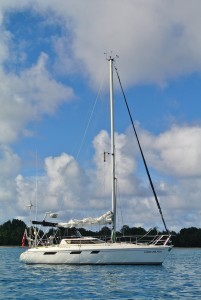
| Vessel Name: | Yarramundi |
| Vessel Make/Model: | Jeanneau Espace 990 33 feet |
| Hailing Port: | Sydney |
| Crew: | David Devlin |
| Extra: | Yarramundi now lies in Mooloolaba and is occasionally sailed with my son. I do plan to evenutally get her to Sydney. |
Yarramundi's Photos - Main
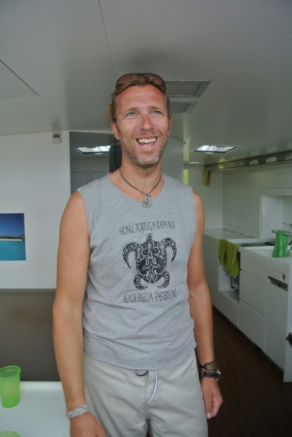 |
Andrew and I don’t think he is human – probably some Viking god who has came back to earth for a visit. He setup a vodka distribution business in 22 countries and sold it to Diageo retiring at the age of 32. He spent the following 2 years designing and building his 56 foot $6 million boat and has been sailing it for the last 6 years. He sails alone and has been everywhere – including Antarctica. Neither of us have seen anything like the boat – The interior is like an upmarket modern Scandinavian apartment, it has every convenience imaginable (both domestic and maritime), and the outside with it’s teak and stainless steel looks like it just came out of a show room. We certainly did not see Bart cleaning it so are convinced it has been blessed. Or he has some little helpers stowed away somewhere and they come out at night and clean it. In fact we did not see Bart do anything else accept hang around and be cool until he left. He does not use a motor. Despite being in the corner of the harbour he untied his huge floating bachelor pad himself and used only the wind to turn the corner and sail out. We motored out to wave him off and even at full throttle could not keep up. He is off to Kyushu and then Hokkaido where he plans to stay for about a year skiing and photographing the wildlife. He had a coffee table book on board. It was of his boat and it’s Antarctic adventures. Of course he would. Very cool guy - we were privileged to meet him in Chichijima, have dinner with him a couple of times and tour his boat.
David
7 Photos
Created 6 April 2012
|
 |
 |
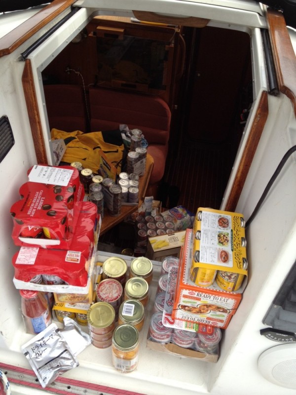 |
Yarramundi is now provisioned with 400 litres of water, 350 litres of diesel, 60kgs of rice and pasta, hundreds of cans of soup, spam, sauces etc to make up more than 800 meals. She is leaning a bit to port side so we will have to do some rearrangement of the contents before taking off on Sunday March 25.
1 Photo
Created 21 March 2012
|
 |
Weather permitting Yarramundi will depart Shimoda, Japan on March 25 for Saipan on her first leg to Sydney. Following that we will sail to Chuuk (Truk) via Guam, then Honiara, Cairns and onto Sydney visiting many of the remote atolls of the Caroline and Solomon Islands.
1 Photo
Created 5 March 2012
|
 |
 |
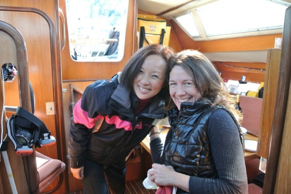
I've been lucky to have my sister Maria and cousins Holly, Adam, Liam and his wife Zoe visit Japan and sail on Yarramundi
6 Photos
Created 24 February 2012
|
 |
 |
 |
Why is it that every winter I've seem have had to dive below the boat to fix or retrieve something?
4 Photos
Created 22 February 2012
|
 |
Yarramundi has been taken to Seabornia Marina on the west side of the Muira Penninsula for some major work. We made it in record time within one day thanks to the 30knot wind from the north but little thanks to George who fell asleep at the helm.
5 Photos
Created 22 February 2012
|
 |
A few friends visited Yarramundi on Seijin no Hi (coming of age day) while she was in Tokyo Bay. A brief sail was followed by a turkey lunch.
10 Photos
Created 20 January 2012
|
 |
People who have helped fit-out and maintain Yarramundi
7 Photos
Created 26 December 2011
|
 |
From Shimoda to Wakayama and Mie Prefectures - a 12 day trip with 3 other yachts from TSPS.
24 Photos
Created 2 December 2011
|
Who: David Devlin
Port: Sydney